 Amplia
Measure distance on a photo
Calibrate once against a distance you already know, then read real lengths straight off the image. Free, and measuring runs in your browser without an account.
How it works
Two steps stand between a photo and real measurements.
Upload a photo and mark one known distance
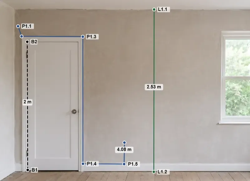
Load any photo, drawing, or plan — or start with the built-in sample image. Place two calibration points on a distance you already know in the real world, such as a door that is 2 meters tall, and enter that reference distance and its unit. This sets the scale for everything else.
Draw lines and paths
Switch to the Line or Polyline tool and click to place points. Real-world lengths appear as labels on the canvas and update live as you drag the points to fine-tune them. Every action can be undone and redone, so a misplaced point is never a problem.
Calibrate once, and every line you draw afterward is already a real measurement.
Two tools for distance
Line
Click two points and read the direct distance between them. Use it for a single wall, a window width, or the gap between two corners.
Polyline
Click each point along a multi-segment route to get the length of every segment plus the running total. Use it for cable runs, baseboards, or a route traced on a map.
When photo distance measurement is accurate
Works well
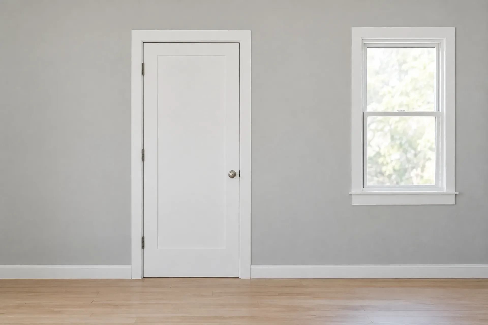
- The photo is flat and front-on, taken square to the surface.
- The image is a floor plan, a blueprint, or a scanned technical drawing.
- The objects you measure are on the same plane as the calibration reference.
- The image is a map screenshot with a visible scale bar.
- You calibrate over as long a reference distance as possible, which minimizes the effect of small clicking errors.
Less reliable
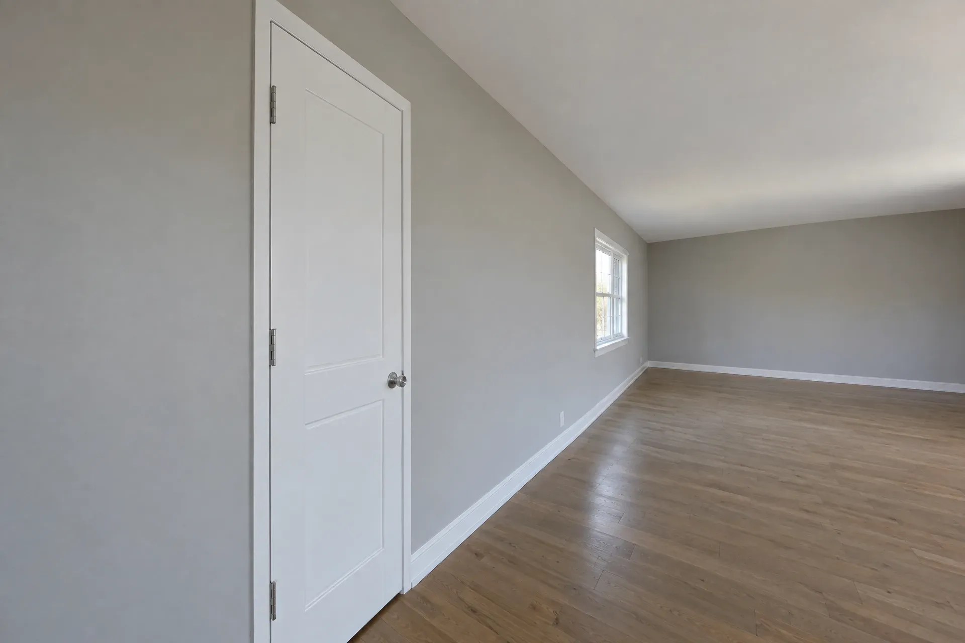
- The subject recedes into depth, so the photo has strong perspective.
- The objects you measure sit at a different distance from the camera than the calibration reference.
- The surface is curved or three-dimensional.
- The photo was taken with a wide-angle or fisheye lens and shows visible distortion.
- The calibration reference you chose is short relative to the image, so a small clicking error becomes a larger real-world error.
If you cannot avoid perspective, calibrate as close as possible to what you are measuring and keep both on the same plane. That limits the error more than anything else you can change once the photo is taken.
Supported units
The units Amplia supports, grouped by system and subsystem.
Distance
Metric
| Symbol | Name |
|---|---|
| nm | nanometer |
| μm | micrometer |
| mm | millimeter |
| cm | centimeter |
| m | meter |
| km | kilometer |
| Å | angstrom |
| pm | picometer |
| dm | decimeter |
Imperial
| Symbol | Name |
|---|---|
| in | inch |
| ft | foot |
| yd | yard |
| mi | mile |
| mil | mil (thou) |
Nautical
| Symbol | Name |
|---|---|
| ftm | fathom |
| cb | cable |
| nmi | nautical mile |
Astronomical
| Symbol | Name |
|---|---|
| AU | astronomical unit |
| ly | light-year |
| pc | parsec |
| ls | light-second |
| lmin | light-minute |
| kpc | kiloparsec |
| Mpc | megaparsec |
| Gpc | gigaparsec |
Typography
| Symbol | Name |
|---|---|
| pt | point |
| pc | pica |
Surveying
| Symbol | Name |
|---|---|
| li | link |
| rd | rod (perch) |
| ch | chain |
| fur | furlong |
What people measure with it
Anywhere you have a photo and a distance you already know, you can measure a length.
Walls & windows from site photos
Take wall lengths and opening widths from a photo of the room, calibrating on a door or a course of bricks. Handy for a quick quote or a shopping list before you order materials.
Furniture from listing photos
Check whether a sofa, table, or appliance will fit through a doorway or into a room before you buy, using a dimension already visible in the shot — a doorframe, a tile, or a listed measurement.
Route length on a map
Trace a path with the Polyline tool on a map screenshot, calibrating against the scale bar, to get the total distance of a hike, a commute, or a cable run across a site.
Part dimensions on a drawing
Read lengths off a scanned technical drawing, blueprint, or floor plan, using its printed scale as the reference — useful for a quick check before you commit to a formal survey.
Frequently asked questions
?How accurate is distance measured from a photo?
Very accurate for objects on the same plane as your calibration reference, photographed square-on — floor plans, scanned drawings, and front-on shots are ideal. Perspective, differences in depth, curved surfaces, and wide-angle lens distortion all reduce accuracy.
?Can I measure a curved or multi-segment path?
Yes. The Polyline tool lets you click point after point along a path and gives you both the length of each segment and the running total — useful for cable runs, baseboards, or a route traced on a map. For smooth curves, the Curve tool (PRO) fits a spline through your points and reports its length.
?What distance units are supported?
Results can be shown in metric (millimeter, centimeter, meter, kilometer and more), imperial (inch, foot, yard, mile), nautical (fathom, cable, nautical mile), astronomical (astronomical unit, light-year, parsec), and typography (point, pica) units. Values are converted for you as you measure.
?Do I need to install anything or sign up?
No. Amplia runs in your browser, so there is nothing to install. You can load a photo, calibrate, and measure with the Line tool without an account. An account is only needed to save projects and to export.
?Is my photo uploaded to a server?
Not when you measure without an account — the image stays on your device and all measuring happens in your browser. It is stored in the cloud only if you sign in and save your work as a project.
?Can I export my distance measurements?
Yes. Line and polyline measurements can be exported as an annotated PDF report, an annotated image (PNG, JPEG, or WebP), an XLSX workbook, or a CSV export of raw unrounded values for scripts and analysis — all of them include the lengths you measured.
?Can I move a point after I've placed it, or undo a mistake?
Yes. Every point stays draggable so you can fine-tune it later, and every action — placing a point, moving it, or discarding a path — can be undone and redone.
?What if my photo was taken at an angle instead of straight-on?
For photos where straight-on isn't possible, Amplia's Perspective calibration (a PRO feature) lets you calibrate against a reference rectangle and extrapolate a scale across the whole plane, instead of relying on a single straight-on calibration line. Accuracy still drops the further you measure from the calibrated plane.
Start measuring distances — free
Open the app and try it on the built-in sample image. No account needed to measure, and your photo stays on your device.